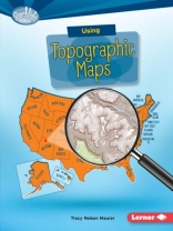
Want to know just how tall Mount Everest is? Or what the city of Denver’s elevation is? Then look at a topographic map! These maps use lines to show the height and shape of Earth’s surface. But how do you read the lines? And what other features do these maps have? Read on to learn the ins and outs of topographic maps!
ภาษา อังกฤษ ● รูป PDF ● ISBN 9781512410754 ● สำนักพิมพ์ Lerner Publishing Group ● การตีพิมพ์ 2016 ● ที่สามารถดาวน์โหลดได้ 3 ครั้ง ● เงินตรา EUR ● ID 5034550 ● ป้องกันการคัดลอก Adobe DRM
ต้องใช้เครื่องอ่านหนังสืออิเล็กทรอนิกส์ที่มีความสามารถ DRM
หนังสืออิเล็กทรอนิกส์เพิ่มเติมจากผู้แต่งคนเดียวกัน / บรรณาธิการ
91,267 หนังสืออิเล็กทรอนิกส์ในหมวดหมู่นี้
ไม่มีผลลัพธ์


